Author: hopesteffen.bsky.social (did:plc:t762z6gm7dc2pqpvikhakn3r)
Collections
Record🤔
cid:
"bafyreihjrczadczhtxiphyij4uzl5ojjny5nabo46ar2tmlzjtyhhalmni"
value:
text:
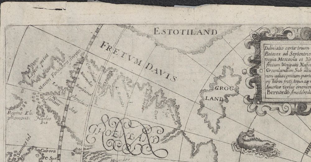
"This detail from de Bry's map is a good example of legend fused with exploration. The Davis Strait was explored in the period 1585-87 & its name represents new knowledge. (1/n)

[Theodor de Bry, 1601, Deliniatio cartae trium navigationum, courtesy of the University of Tromsø]"
$type:
"app.bsky.feed.post"
embed:
$type:
"app.bsky.embed.images"
images:
alt:
"Section of a map of the northern polar region. The section contains a descriptive text on the right-hand side, and below it is a stylised whale. To the left of the text and the whale are three islands, between which is the Davis Strait. The tree islands are Estotiland to the north, Grocland to the east, and Greenland to the south."
image:
View blob content
$type:
"blob"
mimeType:
"image/jpeg"
size:
665814
aspectRatio:
width:
2000
height:
1044
langs:
"en"
createdAt:
"2024-09-19T20:41:09.828Z"